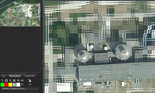
A training system for image analysis has been developed with "ViLand" (visualisation of landscapes), with which typical image evaluation tasks from the field of remote sensing can be processed. Tools for image manipulation and annotation allow professional image processing. Topic-specific input masks allow the creation of standardised result reports.
Editors for annotation and image referencing are used to prepare a training scenario. User inputs are compared and evaluated with the ground truth, i.e. with the signatures actually present in the image.
As part of an e-learning system, ViLand is coupled with a tutor system, a serious game or a simulation system.
In addition, ViLand can also be used as an experimental system for image evaluation within the scope of experiments to measure observer performance.
Modules
- Image display with image manipulation tools.
- Editor for image annotations.
- Editor for reports with transfer of annotated elements from image evaluation.
- Term trees for standardised report generation.
- Editor for image referencing (georeferencing).
- Acquisition, display and evaluation of image evaluation performance.
- Interfaces to Serious Game, Tutor System, and Simulation System via HTTP and WS.
