Brief description
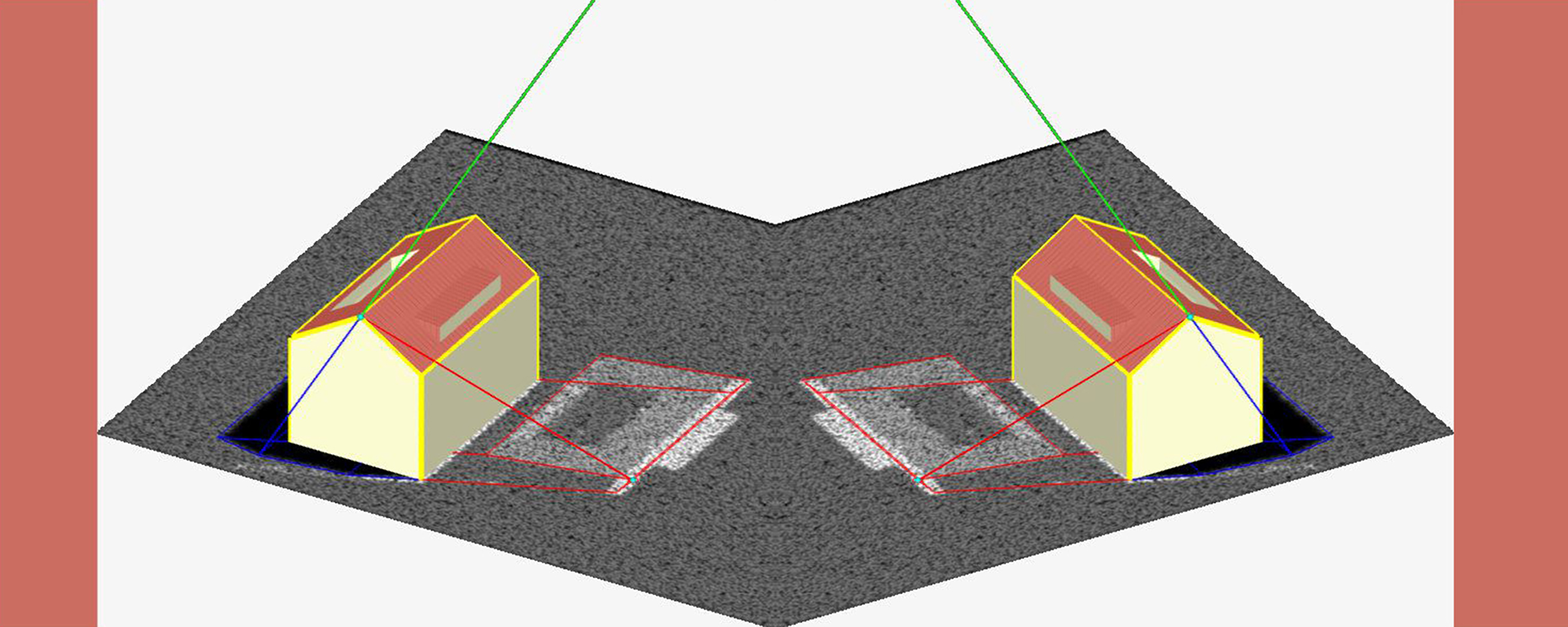
ViSAR is an interactive simulator for the visualization of geometric SAR-effects. The user can generate simple 3D-models and assemble them to complex scenes. For these scenes radar shadows, layover-effects and multi-reflections can be calculated and displayed for different line of sights of a radar sensor.
Keywords
Depressionswinkel, Echtzeit-Simulation, Inzidenzwinkel, Layback, Layover, Radareffekte SAR-Simulation, Shadowing
Task
Due to the operation of the SAR sensor objects are not displayed on the earth as it is used to the human eye. Special geometric and radiometric effects provide valuable information on the actual location of an object and its structural configuration. A SAR image analysts must recognize the geometric and radiometric effects and learn to use.
Solution
»ViSAR« (Visualization of geometric effects in SAR images) provides 3D scenes and calculates SAR images from any camera angles in real-time and additionally shows the complex beam path and the projection of individual points and lines. The user can create scenes from an object library and import objects from other 3D programs. »ViSAR«has been developed as a teaching aid for SAR interpreter.