Analysis of requirements
Urban heat islands degrade the quality of life in many urban centers. This is why local councils of fast-growing megapoli work hand in hand with scientific communities and research facilities to identify and reduce the man-made sources of UHI by imposing forestation, employing sustainable and heat-emissive materials and strengthening public transport. Obviously, most of these measures require not only high financial burdens and interdisciplinary coordination, but also their effect may only be assessed as sensible in a long term. However, large-scale prompt measurements and progress assessments are desirable.
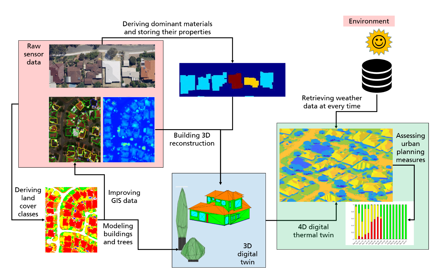
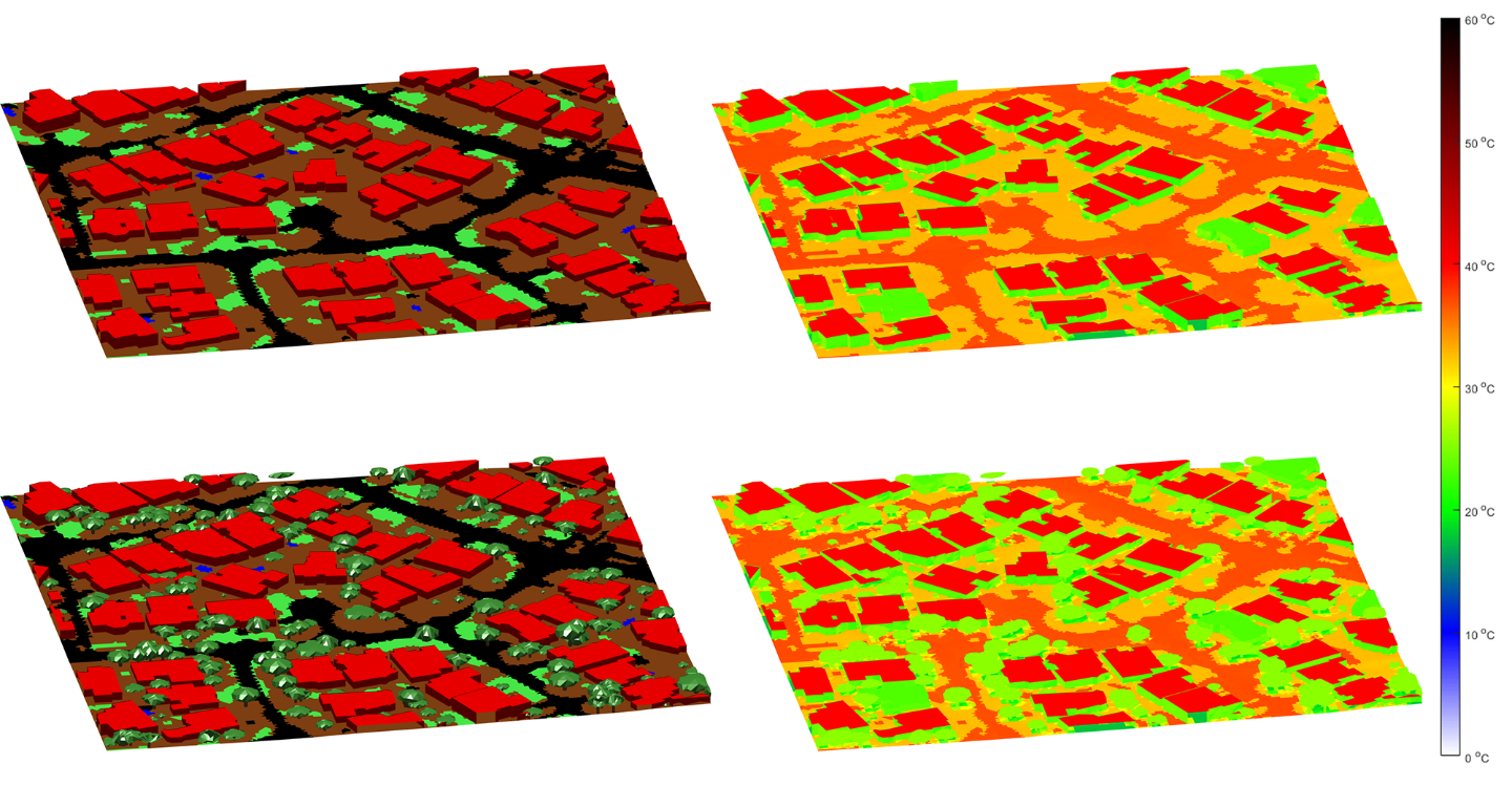
Simulation approaches retrieving unknown surface temperatures using mathematical methods, have many advantages. The costs are predictable and relatively low, even for monitoring large scenes, three-dimensional environments are more easily taken into account, and arbitrary weather events and climatic conditions can be simulated. Simulation even allows an insight into the future, not only enabling reproducing the phenomenon of UHIs but also providing guidelines for their mitigation. With this information, a city planner or a local council are able to save many resources and dispose of a real-time assessment of the measures. The essential requisite is the 4D thermal digital twin representing both the three-dimensional scene and its temporal development. The time axis reflecting growing trees, modified buildings, etc. makes up the fourth dimension.